File:Figure 4.3.7 (G-to-G Public Lands).JPG
Jump to navigation
Jump to search

Size of this preview: 800 × 350 pixels. Other resolution: 838 × 367 pixels.
Original file (838 × 367 pixels, file size: 71 KB, MIME type: image/jpeg)
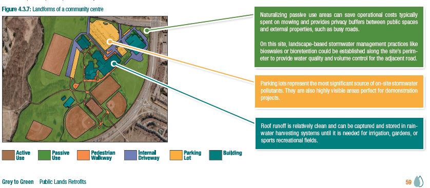
Graphic overview of a park, with different use areas identified.
File history
Click on a date/time to view the file as it appeared at that time.
| Date/Time | Thumbnail | Dimensions | User | Comment | |
|---|---|---|---|---|---|
| current | 15:16, 5 December 2017 | | 838 × 367 (71 KB) | Kyle menken (talk | contribs) | Graphic overview of a park, with different use areas identified. |
You cannot overwrite this file.
File usage
The following 2 pages use this file:
.JPG&oldid=5935)