Difference between revisions of "Inspection and Maintenance: Vegetated Filter Strips"
| Line 20: | Line 20: | ||
*'''[[Swales]]''': Swales are linear landscape features consisting of a drainage channel with gently sloping sides. Underground they may be filled with engineered soil and/or contain a water storage layer of coarse gravel material. Two variations on a basic swale are recommended as low impact development strategies, although using a combination of both designs may increase the benefit. | *'''[[Swales]]''': Swales are linear landscape features consisting of a drainage channel with gently sloping sides. Underground they may be filled with engineered soil and/or contain a water storage layer of coarse gravel material. Two variations on a basic swale are recommended as low impact development strategies, although using a combination of both designs may increase the benefit. | ||
*'''[[Bioswales]]''' are sometimes referred to as 'dry swales', 'vegetated swales', or 'water quality swales'. This type of BMP is form of [[bioretention]] with a long, linear shape (surface area typically >2:1 length:width) and a slope which conveys water and generally contains various water tolerant [[vegetation]]. | *'''[[Bioswales]]''' are sometimes referred to as 'dry swales', 'vegetated swales', or 'water quality swales'. This type of BMP is form of [[bioretention]] with a long, linear shape (surface area typically >2:1 length:width) and a slope which conveys water and generally contains various water tolerant [[vegetation]]. | ||
==Inspection and Testing Framework== | |||
[[File:Visual indicator bioretention.PNG|thumb|300px|Example of a visual indicator to be used when assessing the condition of a given LID feature. Here we see excessive sediment accumulation at the [[inlet]]/[[curb cut]] of a bioretention cell. Source: (TRCA, 2016).<ref>STEP. 2016. Low Impact Development Stormwater Management Practice Inspection and Maintenance Guide. https://sustainabletechnologies.ca/app/uploads/2016/08/LID-IM-Guide-2016-1.pdf</ref>.]] | |||
{| class="wikitable" style="width: 900px;" | |||
|+'''Visual Indicators Framework - Vegetated Filter Strips''' | |||
|- | |||
!<br>'''Component''' | |||
!<br>'''Indicators''' | |||
!<br>'''Construction Inspection''' | |||
!<br>'''Assumption Inspection''' | |||
!<br>'''Routine Operation Inspection''' | |||
!<br>'''Verification Inspection''' | |||
|- | |||
|rowspan="2"|'''[[Bioretention: Sizing|Contributing Drainage Area]]''' | |||
|- | |||
|CDA condition | |||
|x | |||
|x | |||
|x | |||
|x | |||
|- | |||
|rowspan="3"|'''[[Inlets|Inlet]]''' | |||
|- | |||
|Inlet/Flow Spreader Structural Integrity | |||
| | |||
|x | |||
|x | |||
|x | |||
|- | |||
|Inlet/Flow Spreader Structural Integrity | |||
|x | |||
|x | |||
|x | |||
|x | |||
|- | |||
|rowspan="2"|'''Perimeter''' | |||
|- | |||
|BMP dimensions | |||
|x | |||
|x | |||
| | |||
|x | |||
|- | |||
|rowspan="4"|'''[[Absorbent landscapes|Filter Bed]]''' | |||
|- | |||
|Standing water | |||
| | |||
|x | |||
|x | |||
|x | |||
|- | |||
|Trash | |||
| | |||
|x | |||
|x | |||
| | |||
|- | |||
|Filter bed surface sinking | |||
| | |||
|x | |||
|x | |||
|x | |||
|- | |||
|rowspan="4"|'''[[Vegetation|Planting Area]]''' | |||
|- | |||
|Vegetation cover | |||
|x | |||
|x | |||
|x | |||
|x | |||
|- | |||
|Vegetation condition | |||
| | |||
|x | |||
|x | |||
| | |||
|- | |||
|Vegetation composition | |||
|x | |||
|x | |||
|x | |||
| | |||
|- | |||
|- | |||
|}<br> | |||
</br> | |||
[[File:Soil testing indicators.PNG|thumb|300px|The image above shows a manual soil corer, a split soil core sampler kit which preserves the soil sample for further testing (i.e., bulk density) and acrylic core sample tubes. All examples of tools to be use for soil characterization testing. Source: (TRCA, 2016).<ref>STEP. 2016. Low Impact Development Stormwater Management Practice Inspection and Maintenance Guide. https://sustainabletechnologies.ca/app/uploads/2016/08/LID-IM-Guide-2016-1.pdf</ref>.]] | |||
{| class="wikitable" style="width: 900px;" | |||
|+'''Testing Indicators Framework - Bioretention/Swales''' | |||
|- | |||
!<br>'''Component''' | |||
!<br>'''Indicators''' | |||
!<br>'''Construction Inspection''' | |||
!<br>'''Assumption Inspection''' | |||
!<br>'''Routine Operation Inspection''' | |||
!<br>'''Verification Inspection''' | |||
|- | |||
|rowspan="3"|'''Testing Indicators''' | |||
|- | |||
|Soil characterization testing | |||
|x | |||
|x | |||
| | |||
|(x) | |||
|- | |||
|Surface infiltration rate testing | |||
| | |||
|x | |||
| | |||
|(x) | |||
|- | |||
|colspan="7" style="text-align: center;" |'''<u><span title=>Note:''' (x) denotes indicators to be used for Performance Verification inspections only (i.e., not for Maintenance Verification inspections) </span></u> | |||
|- | |||
|} | |||
Revision as of 20:26, 11 July 2022
Overview[edit]
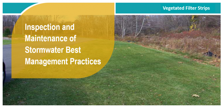
Vegetated filter strips (a.k.a. buffer strips and grassed filter strips) are gently sloping, densely vegetated areas that treat runoff as sheet flow from adjacent impervious areas. They slow runoff velocity and filter out suspended sediment and associated pollutants, and provide some infiltration into underlying soils. Originally used as an agricultural treatment practice, filter strips have evolved into an urban SWM practice. Vegetation may be comprised of a variety of trees, shrubs and native plants to add aesthetic value as well as water quality benefits. With proper design and maintenance, filter strips can provide relatively high pollutant removal benefits. Maintaining sheet flow into the filter strip through the use of a level spreading device (e.g., pea gravel diaphragm) is essential. Using vegetated filter strips as pretreatment practices to other best management practices is highly recommended. They also provide a convenient area for snow storage and treatment, and are particularly valuable due to their capacity for snowmelt infiltration.
Properly functioning vegetated filter strips and soil amendment areas reduce the quantity of pollutants and runoff being discharged to municipal storm sewers and receiving waters (i.e., rivers, lakes and wetlands). In addition to their SWM benefits, they provide aesthetic value as attractive landscaped features.
Key components of Vegetated filter strips to pay close attention to are the:
Trash, debris and sediment builds up at these locations and can prevent water from flowing into or out of the practice.
Associated Practices[edit]
- Grass Swales: A parabolic or trapezoidal-sized bottom, swale that contains grassed sloping sides and a filter media bottom to both convey overland flow and provide water treatment, and are often subject to more frequent maintenance. They generally contain an outlet structure at the lowest point for water to be sent to another LID BMP or the storm system; sometimes referred to as a roadside ditch. Does not contain check dams.
- Swales: Swales are linear landscape features consisting of a drainage channel with gently sloping sides. Underground they may be filled with engineered soil and/or contain a water storage layer of coarse gravel material. Two variations on a basic swale are recommended as low impact development strategies, although using a combination of both designs may increase the benefit.
- Bioswales are sometimes referred to as 'dry swales', 'vegetated swales', or 'water quality swales'. This type of BMP is form of bioretention with a long, linear shape (surface area typically >2:1 length:width) and a slope which conveys water and generally contains various water tolerant vegetation.
Inspection and Testing Framework[edit]

Component |
Indicators |
Construction Inspection |
Assumption Inspection |
Routine Operation Inspection |
Verification Inspection |
|---|---|---|---|---|---|
| Contributing Drainage Area | |||||
| CDA condition | x | x | x | x | |
| Inlet | |||||
| Inlet/Flow Spreader Structural Integrity | x | x | x | ||
| Inlet/Flow Spreader Structural Integrity | x | x | x | x | |
| Perimeter | |||||
| BMP dimensions | x | x | x | ||
| Filter Bed | |||||
| Standing water | x | x | x | ||
| Trash | x | x | |||
| Filter bed surface sinking | x | x | x | ||
| Planting Area | |||||
| Vegetation cover | x | x | x | x | |
| Vegetation condition | x | x | |||
| Vegetation composition | x | x | x |

Component |
Indicators |
Construction Inspection |
Assumption Inspection |
Routine Operation Inspection |
Verification Inspection | |
|---|---|---|---|---|---|---|
| Testing Indicators | ||||||
| Soil characterization testing | x | x | (x) | |||
| Surface infiltration rate testing | x | (x) | ||||
| Note: (x) denotes indicators to be used for Performance Verification inspections only (i.e., not for Maintenance Verification inspections) | ||||||
- ↑ TRCA. 2013. Fact Sheet - LID Manual Master Reference List: Vegetated Filter Strips. https://sustainabletechnologies.ca/app/uploads/2013/01/Vegetated-Filter-Strips.pdf
- ↑ STEP. 2016. Low Impact Development Stormwater Management Practice Inspection and Maintenance Guide. https://sustainabletechnologies.ca/app/uploads/2016/08/LID-IM-Guide-2016-1.pdf
- ↑ STEP. 2016. Low Impact Development Stormwater Management Practice Inspection and Maintenance Guide. https://sustainabletechnologies.ca/app/uploads/2016/08/LID-IM-Guide-2016-1.pdf